

|
|
| Radar image courtesy of Accuweather | Click here for Live Webcam |
| Updated: @ 27-Apr-2024 8:05am - next update at 7:00pm | |||||||||||||||||||||||||||||||||||||||||
| Summary / Temperature | Wind | Rain | Outlook | ||||||||||||||||||||||||||||||||||||||
|
|
|
|
||||||||||||||||||||||||||||||||||||||
| Humidity & Barometer | Almanac | Moon | |||||||||||||||||||||||||||||||||||||||
|
|
|
|||||||||||||||||||||||||||||||||||||||
| UV Index Forecast | UV Index Forecast | ||||||||||||||||||||||||||||||||||||||||
|
|
||||||||||||||||||||||||||||||||||||||||


| NWS Weather Forecast - Outlook: Today & Tonight | ||||||
|
||||||

Radar Map

USA Lightning Map

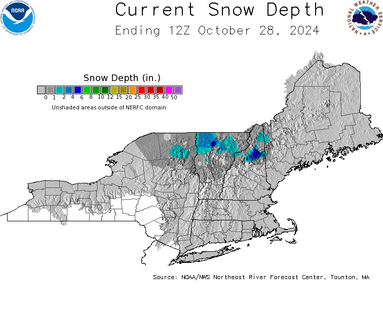
Snowfall